Large Tornado Prompts PDS Warning in Illinois

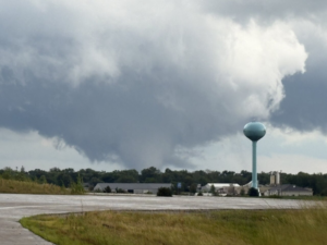
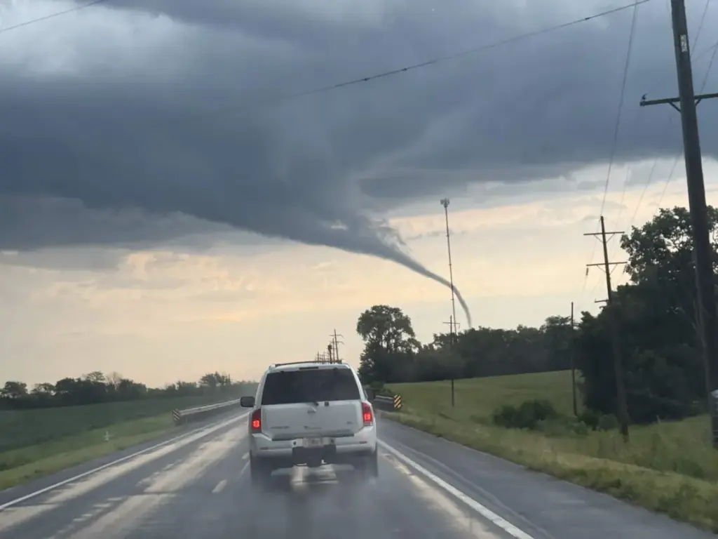
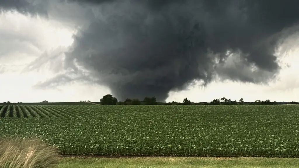
A series of rotating thunderstorms prompted multiple tornado warnings across northern Illinois Sunday night, including a particularly dangerous situation warning for portions of Henry and Bureau counties. At 9 p.m. CDT, the National Weather Service said a large and extremely dangerous tornado was near Johnson-Sauk Trail State Park, about 7 miles north of Kewanee, moving east at approximately 20 mph. Forecasters warned of a potentially damaging tornado and urged residents in its path to immediately seek shelter.

The tornado threat continued farther east through Bureau and Lee counties later in the evening. At 10:44 p.m., the National Weather Service maintained a tornado warning for northeastern Bureau County after radar detected rotation near La Moille, about 9 miles west of Mendota. A separate warning remained in effect for southeastern Lee County, where another rotating storm was located near Paw Paw. Farther south, another tornado warning was active for parts of Marshall, Stark and Peoria counties, where forecasters said a storm capable of producing a tornado was near Wyoming and moving east at 25 mph. Residents were warned that nighttime tornadoes can be difficult to see and not to wait for visual confirmation before taking shelter.

The broader severe weather threat was expected to persist overnight and into the beginning of the workweek. A severe thunderstorm watch covering much of northern Illinois remained in effect until 4 a.m. Monday, while a flood watch extended through 7 a.m. across northeastern Illinois and northwest Indiana. Forecasters said repeated thunderstorms could produce localized rainfall rates exceeding 2 inches per hour, with some areas already receiving between 1 and 3 inches Sunday. Additional rounds of thunderstorms were expected Monday through Wednesday, bringing continued risks of flash flooding and severe weather, particularly Monday into Tuesday.

This post has been updated with new information since it was published.

Severe Weather Strikes the Midwest – More Expected Today

Over the last week, the Midwest has been ravaged by rounds of severe weather, including a rare phenomenon called a derecho and a tornado outbreak. Today, there is a moderate in place over some of the areas already hit and effected by last week’s storms.

In the last week, a Derecho and multiple tornadoes, including two EF-3s, struck portions of Illinois and Indiana. Today, there is a Moderate Risk (level 4/5) of severe weather, in an “all-hazards expected” type of day. Tornado Watches have already been issued, with long track, potentially violent tornadoes possible.

Severe weather strikes the midwest - more expected today

From last week, two of the hardest hit areas were Streator, IL and Koutz, IN. Multiple meteorologists and storm chasers were covering these storms as they moved through the area. Some tornadoes were estimated to be stronger, but simply didn’t do damage to gain a higher rating. This would include Dwight, Washburn, and Ipava, IL.

From Left to Right: The Dwight, IL tornado. Credit: Tim Cygnar; The Ipava, IL tornado. Credit: Storm Chaser Jared King. The Washburn, IL tornado. Credit: Meteorologists Brandon Weart and Daniel Wefer.

The Faytuks Weather team will be monitoring and tracking Severe Weather throughout the afternoon, and updating on our X Account as the day progresses.

LIVEM7.8 Earthquake Strikes Philippines – Tsunami Advisories Issued

A preliminary Magnitude 7.8 Earthquake has struck in the Philippines, causing Tsunami Advisories to be issued in areas in the Pacific. The depth as reported by the United States Geological Survey (USGS) has the depth estimated as 35km, or about 22 mi underground.

Preliminarily, the epicenter is estimated to be 24 miles west southwest of Burias, Philippines, located in the Pacific Ocean. In the Philippines, a Tsunami Warning has been issued, for wave heights of more than 1 meter above normal tides, with a risk for higher waves in closed bays and straits. The US Tsunami Warning Center has issued advisories for most of the pacific islands, along with Guam. Japan has also issued a Tsunami Advisory.

Early images are coming out, with collapsed buildings. Live streams from the area are repeating the last few seconds of shaking before being taken offline.

The Faytuks Weather Team has made this a live blog, and will be updating as we get more information.

Tropical Storm Amanda Forms in the Eastern Pacific

Tropical Storm Amanda Credit: CIRA/NOAA

The National Hurricane Center (NHC) is tracking Tropical Amanda in the Eastern Pacific basin, 1475 miles south of Baja California. This storm originally was Tropical Depression One-E. There is no threat to population with this storm.

At the 8 AM NHC Advisory, Amanda had sustained winds of 40 mph or 65 km/h. The minimum central pressure was at 1006 mb, moving northwest at 8 mph or 13 km/h. Amanda is expected to strengthen over the next few days, before becoming subtropical and dissipating.

While not being the earliest tropical storm to form in the eastern pacific basin, it is earlier than average for the first storm to form, which is June 10th. The eastern Pacific hurricane season runs a little bit longer than both the central Pacific and Atlantic hurricane seasons, as it runs from May 15th until November 30th. Both the Atlantic and central Pacific seasons run from June 1st through November 30th.

Elsewhere in the basin, the NHC is monitoring two other areas of interest just off the west coast of Mexico, one at 20% and one at 50% chances of formation within the next 7 days.

Faytuks Weather Network will be monitoring this storm, and all of the tropic basins throughout the season.

U.S. Severe Weather Update – April 27th, 2026

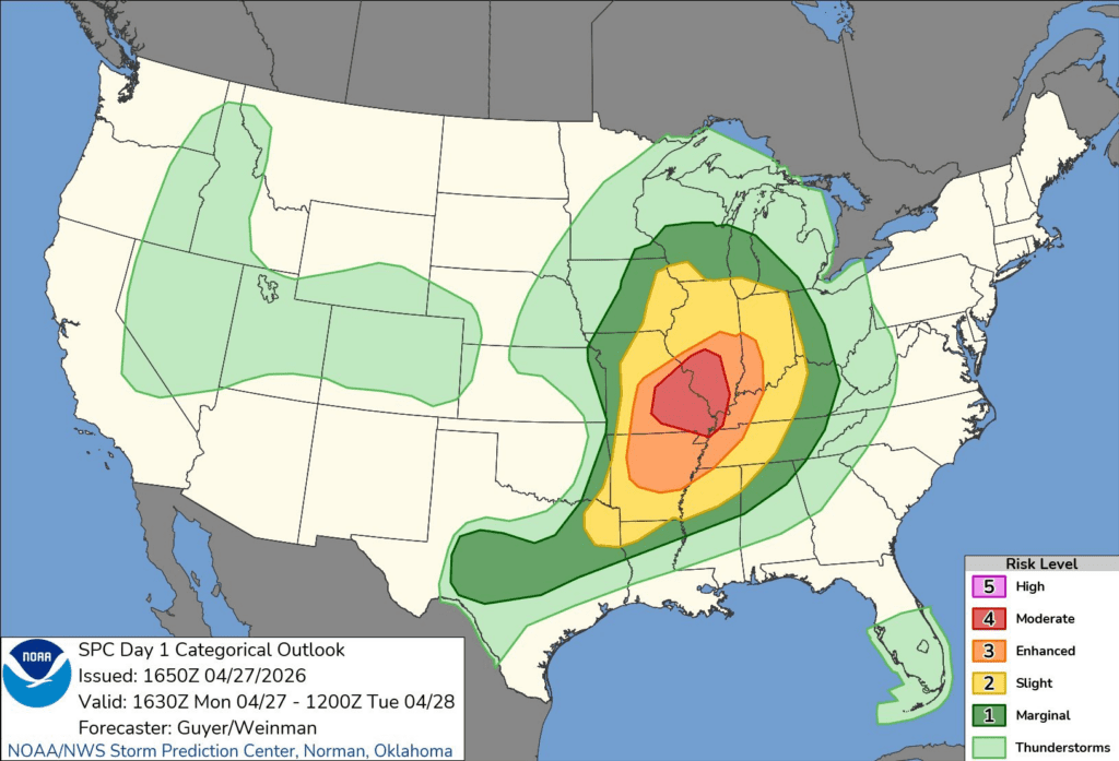
NWS Storm Prediction Center Day 1 Outlook

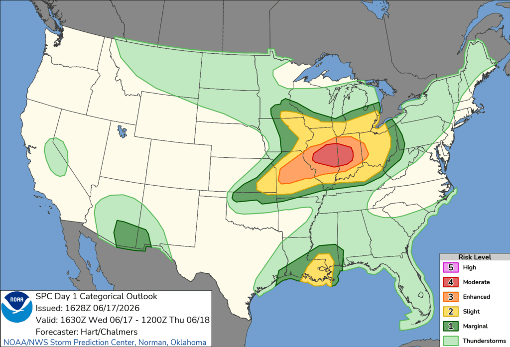
The Storm Prediction Center has issued a Moderate risk (Level 4/5) today in an all hazards type severe weather day for portions of eastern Missouri and southwest Illinois. Within this risk, there is a 15% CIG (Conditional Intensity Group) 2 for Tornadoes. What this means, is that within a 25 mile radius of hose in that risk, there is a 15% chance of an EF3 tornado, which would indicate winds between 136-165 mph, or 219-265 kph. Tornadoes aren’t the only risk today though, as there is also a 45% wind risk, which would indicate a good chance of severe wind gusts of over 60 mph or 64 kts. Finally, there is also a 30% CIG 1 risk for Hail, which means that there is a 30% chance of hail that is 2+ inches in size, or about the size of a hen egg.

Nws storm prediction center day 1 outlook
Day 1 severe weather outlook. Image: NWS/SPC

The reason why this severe weather set up is so interesting, is that as of writing there is a line of storms going through Central Illinois. What this should do is limit the atmosphere and it’s ability to recover instability to make this outbreak more widespread. Unfortunately, even with that line of storms going through up north, meteorologists are still very confident in the main moderate risk. Overall, it has been shaping up to be a big severe weather impact day.

Due to the severe weather forecasted, over twenty school districts within the St. Louis metro either have closed, or will close early today. If you are placed under a warning today, ensure you are sheltering in a sturdy building, in the lowest interior room with no outside walls. Make sure you are wearing or have closed toe shoes ready, and bring a helmet if you can! If you are caught driving, do not shelter under an overpass. Being under an overpass during any type is dangerous as the overpass almost acts as a tunnel for wind and rain.

The Faytuks Weather team will be monitoring this event throughout the day, and posting updates to the twitter as we can.

Deadly Tornado Outbreak Kills Several Across US Midwest and Plains

A deadly tornado outbreak swept across parts of the central United States on Friday, March 6, leaving several people dead and causing widespread damage in multiple states.

Early reports say at least eight people were killed as tornadoes struck communities in states including Michigan and Oklahoma. Emergency crews spent Saturday searching damaged areas and assessing destruction while the National Weather Service works to confirm how many tornadoes touched down during the outbreak.

Some of the most severe damage occurred in southern Michigan, where a tornado hit areas near Union City and along the St. Joseph River. Officials in Branch County confirmed multiple fatalities and several injuries after homes were torn apart and debris scattered across roads and farmland. Another death was reported in nearby Cass County as the storm system moved through the region.

Residents described roofs ripped from houses, trees snapped in half, and vehicles thrown across yards. Hundreds of people were left without power overnight as crews worked to clear roads and restore electricity.

Earlier in the outbreak, two people were killed in western Oklahoma after a tornado struck near Fairview. Authorities said a mother and her teenage daughter died when their vehicle was caught in the storm along U.S. Highway 60. They have been identified as mother and daughter, Jodie and Lexi Owens.

Additional fatalities were reported in Okmulgee County, Oklahoma, where a tornado damaged homes and businesses in the town of Beggs. Emergency crews responded to reports of destroyed buildings, overturned vehicles, and downed power lines as the storms moved through the area.

The storms were part of a larger severe weather system that moved across the Plains and Midwest between Thursday and Saturday, producing several tornado warnings and large areas of damaging winds and hail.

Meteorologists say it may take several days for the National Weather Service to complete damage surveys and determine how many tornadoes formed and how strong they were.

Officials are urging residents in affected areas to remain cautious around damaged buildings and downed power lines as cleanup efforts continue.